
KORSMAN CONSERVANCY
HISTORY Part 3: W
ater Level
The water level of the pan has varied over the years between flooding into the road and drying up completely. Historically, the pan was fed by stormwater runoff, seeps and springs. Ground water still seeps out at points around The Drive during wet periods.
Decades ago, when the level rose, frogs, snakes and crabs escaped the flooded grassland and migrated over the road into the gardens. Many frogs were killed trying to cross The Drive. Migration of frogs to other pans in the area is virtually impossible due to urban development.
Historic aerial photos show the pan level was formerly much lower. The pan dried up regularly during winter in the early 1960s. Other records are 1973, 1993 (estimated) and 2004, during which times the pan smelled terrible.
Every time the water level dropped, residents protested to Council to manage the situation and put forward suggestions, some impractical. A resident insisted that water should be trucked in to feed the birds, but it was pointed out that the birds would fly away to find water and wouldn't go thirsty. The animals were given mains water.
In the 1960s, a resident offered to sponsor boreholes, which was initially turned down by Council. Eventually boreholes were drilled on the northern side in 1966 but no water was found. The capped boreholes are presently under water.
In the 1970s, Benoni council supplied semi treated effluent to the Pan from a line that fed effluent to the foundries in Main Reef Rd for cooling. They cut into the supply line along Main Reef Road and the water ran into the storm water channel along the railway line, then into the channel at Drury Lane to supply the Pan.
In 1983, when the Pan water level was low, the flamingos built nests in the Pan, but when the water level rose it covered the nests and they moved on. There was a drought up north and at the time it was the furthest south they had built nests.
Nowadays, the average water level is higher due to increased storm water runoff from higher rainfall and more intense storms. 17 storm water inlets and culverts drain into the Sanctuary. A 140 million litre per year municipal water leak at the railway line, which started in about 2008, raises the level by about 35cm a year. Investigations are still underway by Ekurhuleni to find and repair the leak.
When a water evacuation pump is installed, high water level can be managed by pumping the water to Middle Lake via a channel along the Divot St edge of the golf course.
In April 2022 the Pan reached its highest ever known level of 2.31m (measured at its deepest point) flooding more than half of The Drive in places. This was after the pump had already been running for two months.
Ongoing densification, water and sewerage leaks and more intense rainfall events from climate change make it it unlikely that the pan will dry up again.
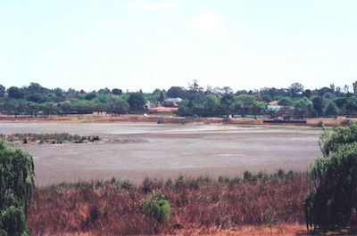
October 2004 Dry pan
)
)
Press clippings from 1967 and 1973 about the water level. Click on thumbnail for full image
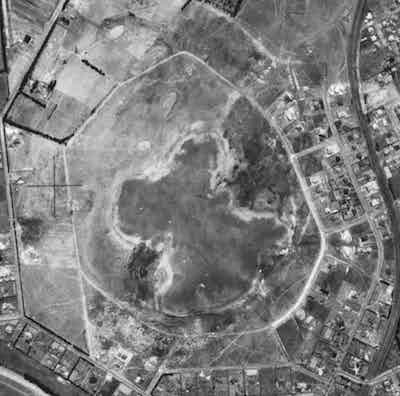
1938 aerial photo. The pan is dry.
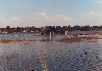
1996 flooding
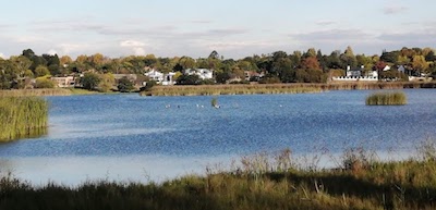
April 2022 flooding. The rock island has almost disappeared.


